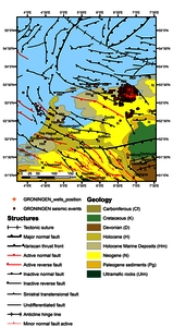
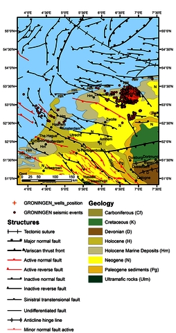
Mazur, Stanisław Geological map of Groningen site - large. [Image]
![[img]](https://episodesplatform.eu/eprints/2359/1/GRONINGEN_10p2_large.jpg)
|
Image
GRONINGEN_10p2_large.jpg Download (4MB) | Preview |
| Item Type: | Image |
|---|---|
| Additional Information: | Contains information licensed under the Open Government Licence – Canada (Open Government Licence - Canada): OF 5529: “Generalized geology of the world: bedrock domains and major faults in GIS format: a small-scale world geology map with an extended geological attribute database” (https://doi.org/10.4095/223767) |
| Subjects: | Region > Netherlands > Groningen |
| Project: | SHEER project > GRONINGEN FIELD: conventional hydrocarbon production |